Social and Political Factors in Indian archaeology
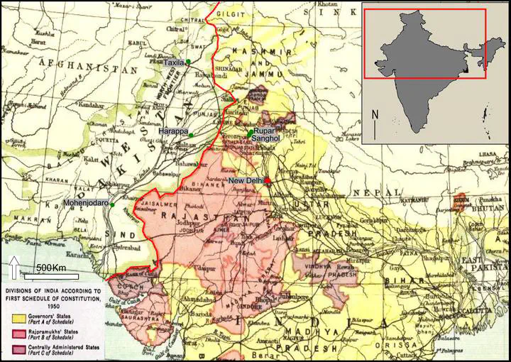 Map representing geopolitical and administrative units in northern India in 1950. New Delhi, the nation’s capital is represented in red, and the approximate locations of Mohenjodaro, Harappa, Taxila, Rupar and Sanghol are in green. The international boundary, in red, between India and Pakistan is approximate. Adapted from ‘Divisions of India according with the first schedule of the Constitution (1950)’, 1953
Using a geographic approach, I show how geopolitical tensions and the desire for internal political stability influenced archaeological practices in post-colonial India. In the aftermath of Prime Minister Indira Gandhi’s assassination in 1984, local archaeological investigations in Sanghol, located 200 kilometres from the sensitive Pakistan-India frontline, piqued the interest of the Archaeological Survey of India, the national department for archaeology and heritage management. The Survey subsequently carried out collaborative field studies in Sanghol between 1986 and 1990, reflecting the changing relationship between the local community and the national government at a time of intense political uncertainty. This study was part of my doctoral dissertation.