MINA | Map Indian ArchaeologyJul 27, 2017Go to Project Site PDF Code Photo by Neha GuptaHeritageAssociate Professor, AnthropologyMy research interests include digital and geospatial methods, geovisualization, data governance, archaeology and cultural heritage.
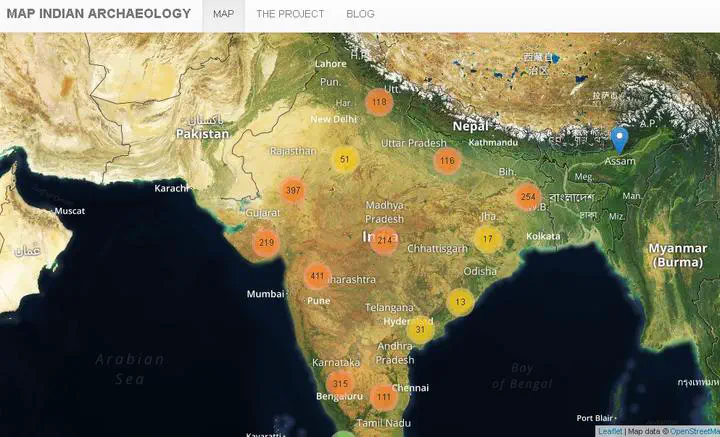 Photo by Neha Gupta